Saturday, July 11, 2015

Castro Point/Magnum Force

IMG_1065
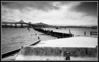
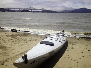
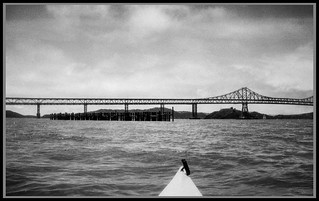
Last weekend was another weekend of taking the kayak out. This time around though I stuck closer to home and headed out North Richmond after the morning marine layer had lifted. A few weeks prior I had been on a date and the conversation had turned to various Dirty Harry films and SF Bay locations. I had oddly been struck that I had no idea where the ending of Magnum Force had been shot. The near ending of the film takes place aboard two WWII era light carriers (CVE's) and at the time I remembered that you could make out bridge in the background.
IMG_1066
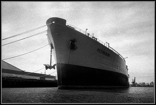
I think the consensus of the conversation had been that it was shot around Pier 54 in SF, but it seemed odd and I actually thought it had shot up in Suisson Bay area with one of those bridges in the background. So after the date I came home and did a lot of internet searching and found that it had been shot in Richmond area. It turns out that few military based BBS boards had hit the subject and tracked down two CVE's in question ("USS Badoeng Strait (CVE-166)" and "USS Rabaul (CVE-121" to be exact). Both had been stricken and sent to Richmond to be scrapped at this time.
Richmond.01020
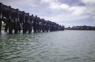
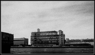
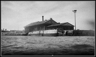
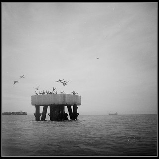
The Pier in question (Point Richmond Pier 90)had been abandoned some time later and and over the decades since had collapsed. On one of the BBS boards it was indicated that collapsed pier was actually still findable depending on tide level and could be seen via google maps of the area. The area in question is just due north of San Rafeal/Richmond Bridge and part of it had been opened as a state park. I had actually once kayaked the area several months prior but had no idea of it's background at the time.
Screen shot 2015-07-10 at 11.03.51 PM
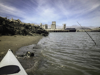
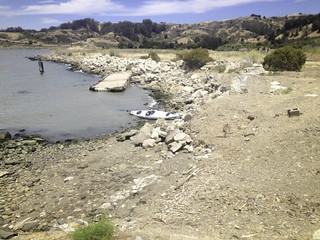
Anyway, so last weekend I took the kayak out to re-explore this area. I easily found the old pier, or what was left of it. Landing at the base of the pier wasn't that easy due to all the rocks and that it was all fenced off too (not open to the public). I kind of expected the state park rangers to show up and kick me out too. Oh well. The rest of the trip was kind of boring and the wind was kind of killer too, so kayak never tracked well in the water always wanting to veer starboard or larboard depending on where I was in the water. I also kept having my left foot fall a sleep. Ugh, which sucks.
Richmond.01027

Friday, July 3, 2015

Kayaking Hunters Point

HuntersPoint.01
With the nicer weather and a long weekend I tempted by the bay and pulled the kayak out of storage and headed over to Islias channel in SF to take the kayak out for few hours on the water. I circled the small bay getting my bearings and expecting my left foot to fall asleep (it always does). So after about 15 minutes of paddling I had to put in and let the blood get back into my leg again
IMG_0941
After I could feel my foot again I headed straight out of Islais channel, past piers 80, 90 and 94, pulling south past pier 96 where the US navy parks SS Petersburg (reserve fleet). I've pasted this ship once before about a ear ago and I've never seen anyone on board. I did keep my minimum distance away as I pasted it. But I did stop to take a few photos from the new to me Nikonos. From what I've read, the SS Petersburg is a refueling ship that the Navy has owned since the mid 60's.
IMG_0953 East.bay.004945
The next leg of the trip took me across Lash Lighter and Indian Basin. I'm not that fond of this part of the paddle generally due to the west to east winds that take toll on my paddling. But I guess I was lucky as the winds were not that strong as a whole and about 20 minutes later I had passed across and rounded into the old SF Bay Navy yards.
East.bay.004981
At the very norther end of the base is a set of 3 dry docks that used to handle repairs on Destroyer, cruisers and submarines. None of the dry docks are in great shape these days and the long caisson that would normally have been in front of the three docks looks to have sunk with noticeable holes in it. Oh well. After exploring the larger of the three I had a near mile paddle to Point Avisadero to explore another set of dry docks
S0111747
The Point Avisadero dry docks (a pair of them) are tad bit older and larger then the three I had passed earlier having been build around the time of WWI. The sizes of the two dry docks are noticeably larger as they were built with battle ships and large liners in mind. Architecturally they are also different. They are built almost as reversed pyramids with large steps along each side of the dock. I'd visited these two about a year ago and had planned this time around to try and exit the kayak and do a little bit of exploring. Unfortunately i had timed my visit badly and the tide hadn't rolled in as much as I need it too and I couldn't tie the boat off and exit without swimming. Ugh.
East.bay.004950
The next leg of the paddle would take me to the last of the Hunter point dry docks and past the large Gantry crane that looms above the base. This wasn't quite another mile of paddling, but did open me up to some of those west to east winds I hate so much when I paddle. I made my way around the large docks that straddle the last of the big dry docks. Back in the day you could park aircraft carriers on these docks and park a Enterprise in the dry dock in question. But today they long abandoned and kind of lonely
Photo of a big bunny rabbit!
The caisson for this lat dry dock was actually located at the rear and it looked like tide was far enough in that I could leave the kayak and start to explore. After finding a spot to tie of and exit the boat I poked my head above edge of the dock I caught what I was afraid to see, about a 100 yards away was a small parking lot filled with cars and trucks. If I had left I would easily have been seen and caught. Ugh. Anyway, dropped back down and used the time to reload the camera. I also used the stop to fill back up on water.
East.bay.004949 East.bay.004947
The reverse trip back to Islais channel was rather uneventful, other then reversal in the wind around pier 94 which pushed me back into the SS Petersburg. So by the time I was back at the landing exhaustion was pretty the point of order. It took me another 30 minutes to load up the boat to the Element and I was off to find some food and caffeine. The paddle took me about 3 hours and was just less then 8 miles of paddling.
East.bay.004979